4GEON Geoparks
Ngorongoro Lengai UNESCO Global Geopark, Tanzania
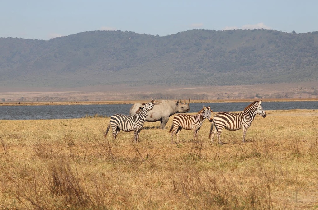
Ngorongoro Lengai is located in northwestern Tanzania, received official global geopark status from UNESCO in 2018. The geopark covers rocky hills, lengthy underground caves, lake basins, a hominid discovery site, and the active Oldonyo Lengai volcano. The main highlights are Ngorongoro crater, Olduvai Gorge, Olmoti crater, Laetoli footprints, Nasera rock, and Olkarian Gorge. One of the Geopark’s central features, the Ngorongoro Crater, harbors a great diversity of wildlife species, like elephants, black rhinoceri, lions, gazelles, and other large mammals, living in co-existence with humans. The geopark’s highest point is the Oldonyo Lengai (2,962m) a sacred mountain for the Maasai community (‘Mountain of God’ or ‘Holy Mountain’ in Maasai language) which is also the unique active stratovolcano of calcarenite in the world. The Geopark’s geological history begins 500 million years ago with granite sand gneiss seen in the North (Gol Mountains) and in the West around Lake Eyasi. Geopark’s territory lies in the eastern arm or branch of the Great Africa Rift Valley which emerged in the Early Miocene, dating back to 20 million years. The geopark is home to some 30,000 large animals, mostly hooved (ungulates), and boasts the highest density of mammalian predators in Africa - including lions, leopards, cheetahs. It also supports one of the largest animal migrations on Earth, including zebras, Thomson and Grant gazelles, and over 1 million wildebeest. In addition, there are over 500 different species of birds in the geopark, including flamingos, ostriches, and colorful lilac-breasted rollers. The geopark is also home to a wide variety of flora, ranging from giant trees in rain forests on the eastern flanks of the volcanic highlands to short grasses and thorny bushes in very arid areas. An array of wildflowers exists throughout the geopark as well. Visitors to the geopark will have opportunities to learn from local guides about the unique flora and fauna near their homes.
The Geopark is home to multiple ethnic groups. The most prominent are the Masaai peoples who migrated southeast from the Nile area in the 18 th century. Also present are the Datoga, Irawq, and Hadzabe Tribes. The Maasai and Datoga are pastoralists, while the Iraqw are agriculturalists. The Hadzabe Tribe is an indigenous ethnic group located in the Lake Eyasi area. With a population of less than 1000, they are hunter-gatherers and are not closely related to any other ethnic group in the area. The differing cultures and cultural heritage of these groups is in part a reflection of differences in local plant and animal ecologies, which, in turn, are controlled largely by differences in local geology and weather. Thus, the geopark offers a unique window into the complex interplay among geology, weather, plant life, animal life, and human cultural development. The geopark is also rich in local heritage and lore. The different tribes each have their own unique ways of life that, together, provide a variety of traditional practices, legends, tales, songs, and dances. One of the geopark’s main purposes is to explore, support, and celebrate the amazing diversity of cultures within its borders. Geopark support local residents earn a sustainable living from these geological features without interfering with their natural settings. The main economic activities in the Ngorongoro Lengai Geopark are pastoralism which is deeply embedded in the culture of the Maasai and Datoga, agriculture, tourism, and small-scale trading. The area is rich in cultural sites often linked to local traditional rituals, such as the Datoga graves, which are an important pilgrimage site for the Datoga tribe. The geopark is a popular destination for people who want to visit geological sites such as the Ngorongoro crater, Lake Natron and Eyasi as well as for people passing through on their way to popular national parks such as Lake Manyara and Serengeti.
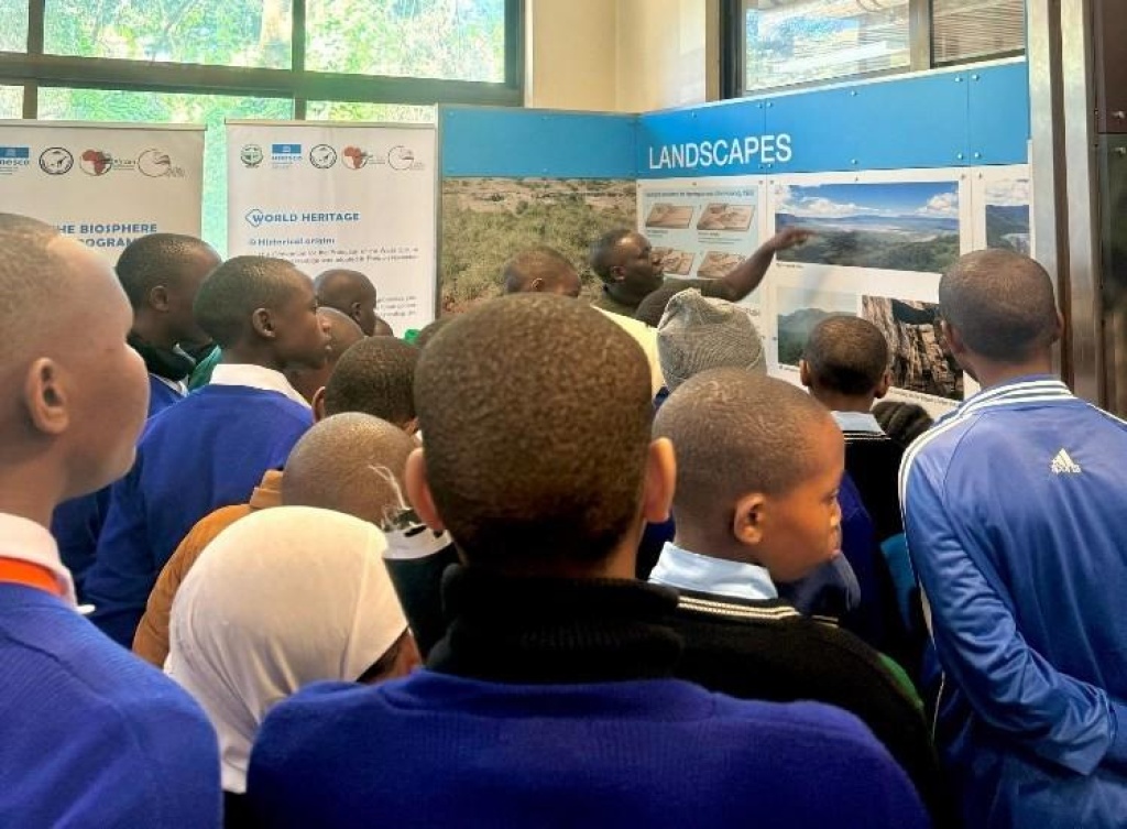
Student Visits to Ngornongoro-Lengai Geopark Museum
geobusgeocourseNgorongoro Lengai2025-12-15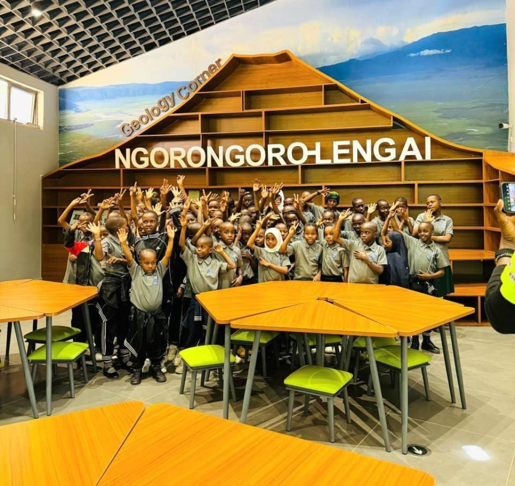
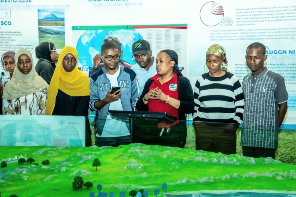
Several groups of students from geoschools visited our new interpretative geosite - the geopark museum.
Sport + Geo = Fun!
geocontestgeocourseNgorongoro Lengai2025-11-30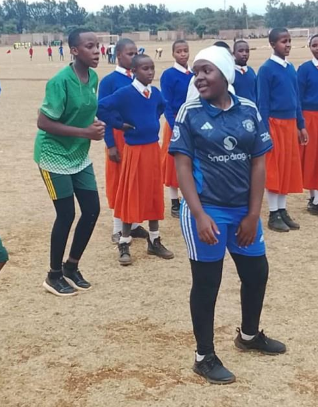
4GEON youth activities in Ngorongoro-Lengai Geopark combine sports with geoeducation.
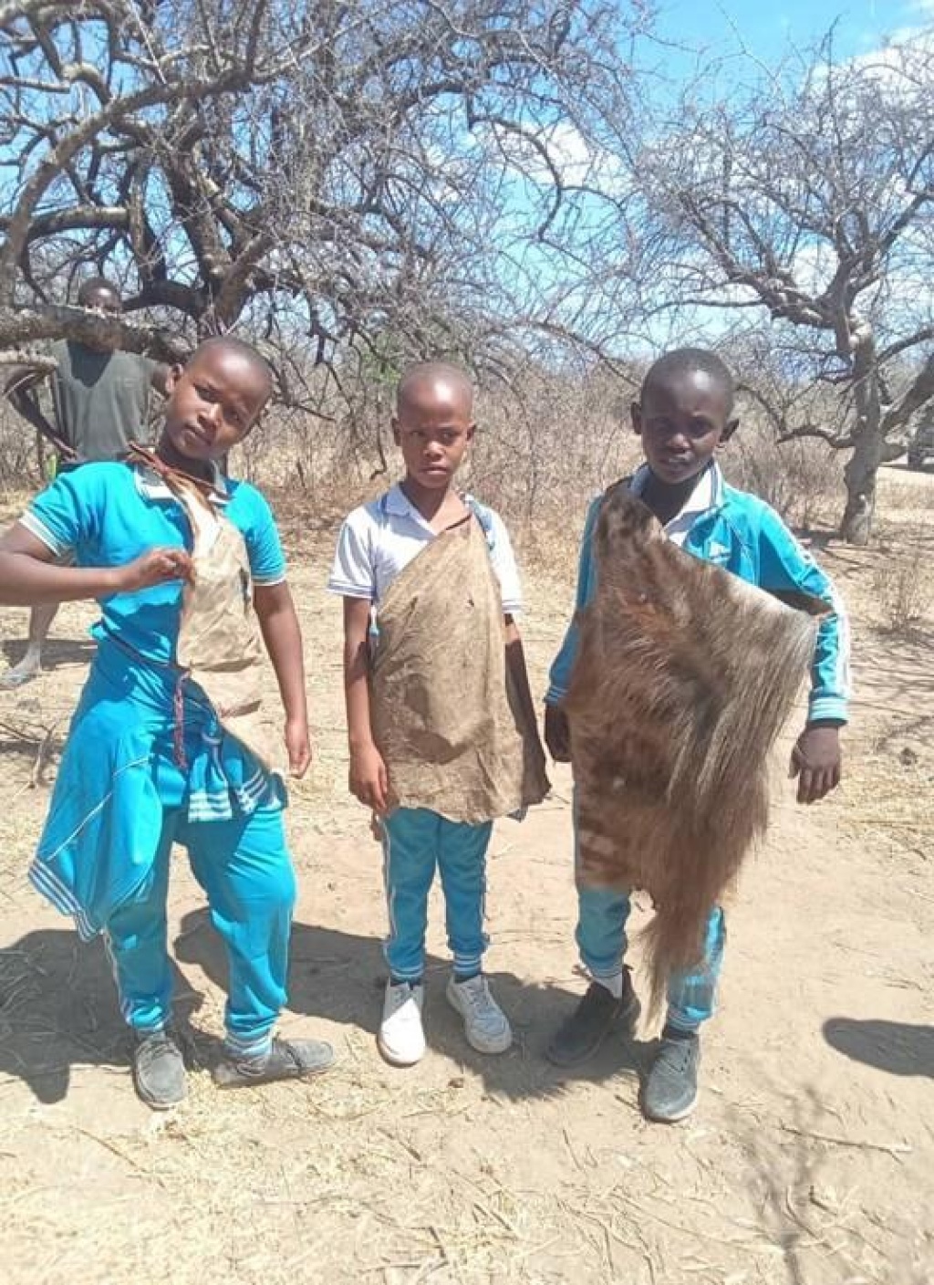
Ngorongoro-Lengai Field Trips and Community Outreach
Ngorongoro Lengai2025-11-05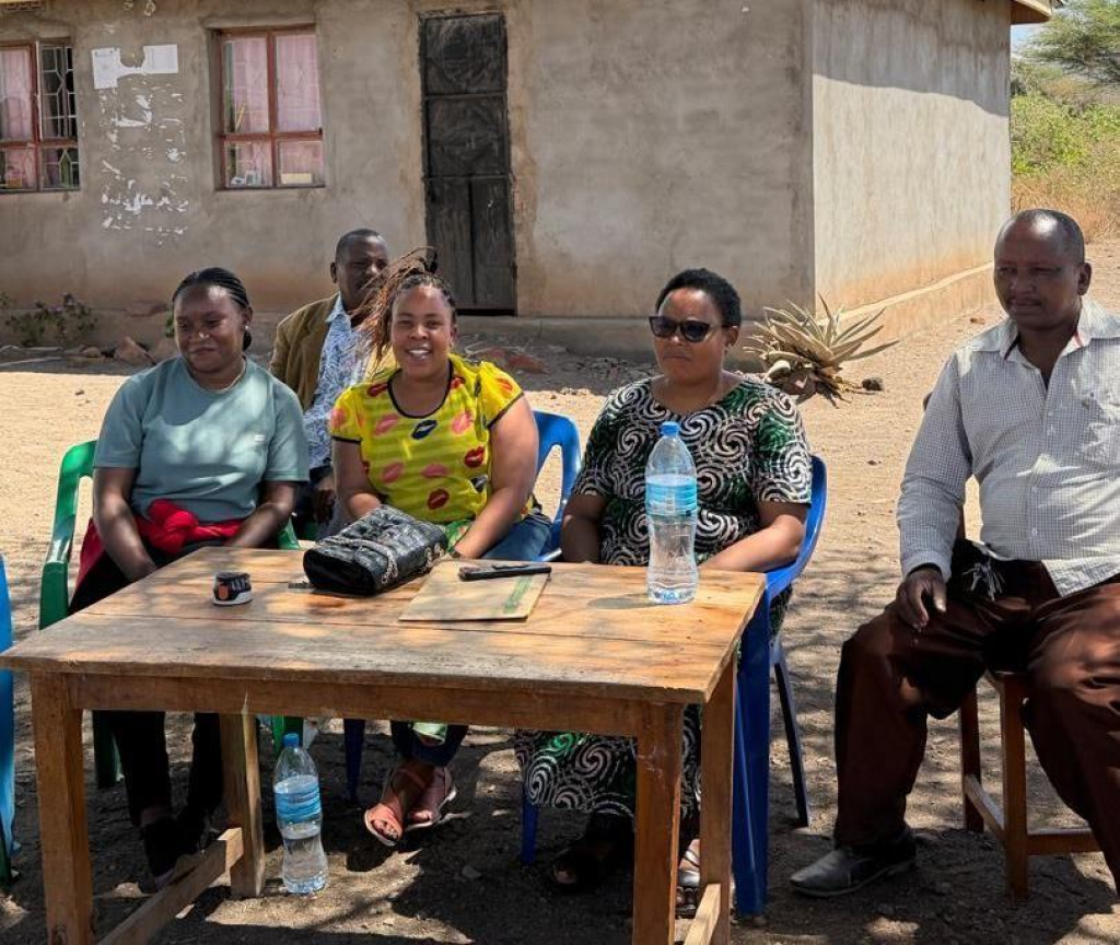
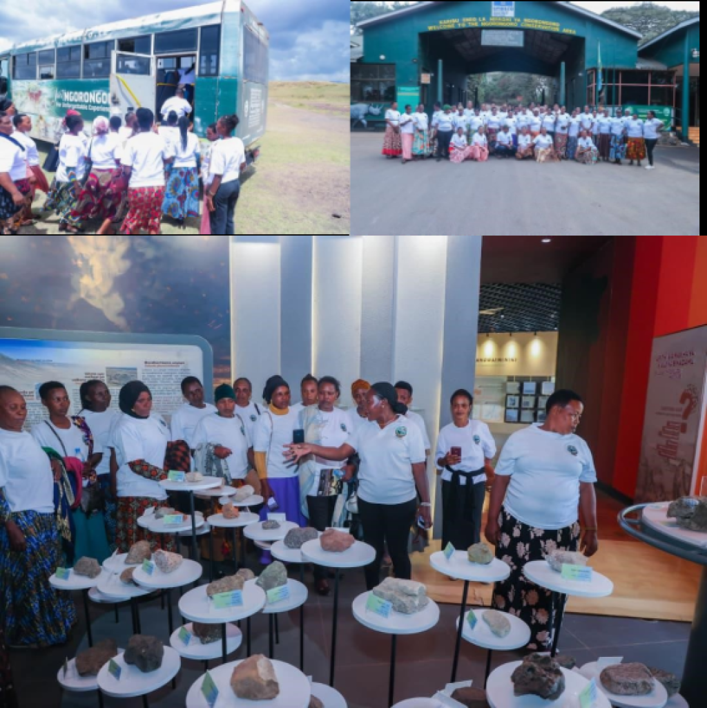
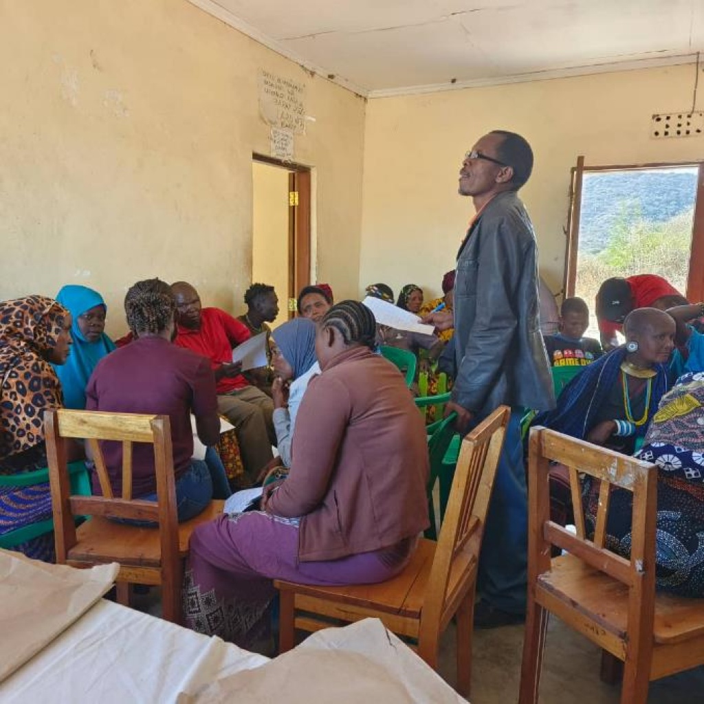
Ms. Lightness Kyambile, a 4GEON project member from NLUGGp conducting meeting with local community on 4GEON project and geoconservation education.
4GEON Represented in Chile at Global Geoparks Conference
BoholColca & AndaguaNgorongoro LengaiRio Coco2025-09-12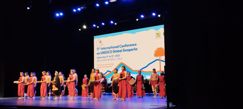
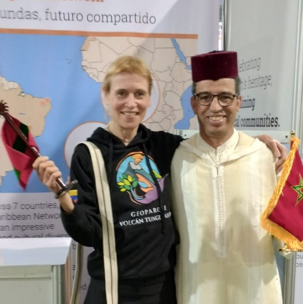
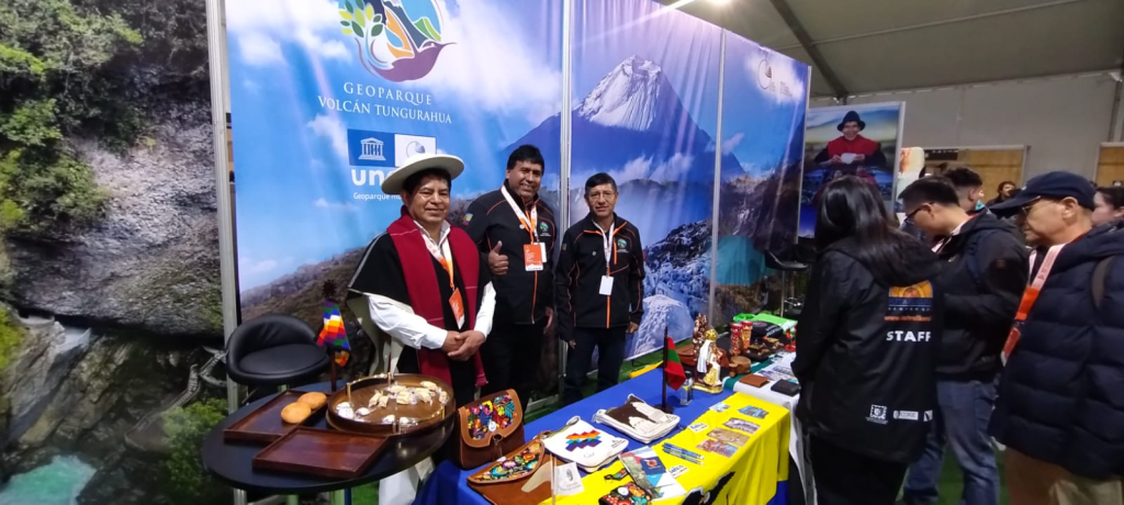
11th INTERNATIONAL UNESCO GLOBAL GEOPARKS CONFERENCE 2025, Kutralkura Geopark Chile
Ngorongoro-Lengai Geopark Museum and other Interpretation Improvements
geobusNgorongoro Lengai2025-08-31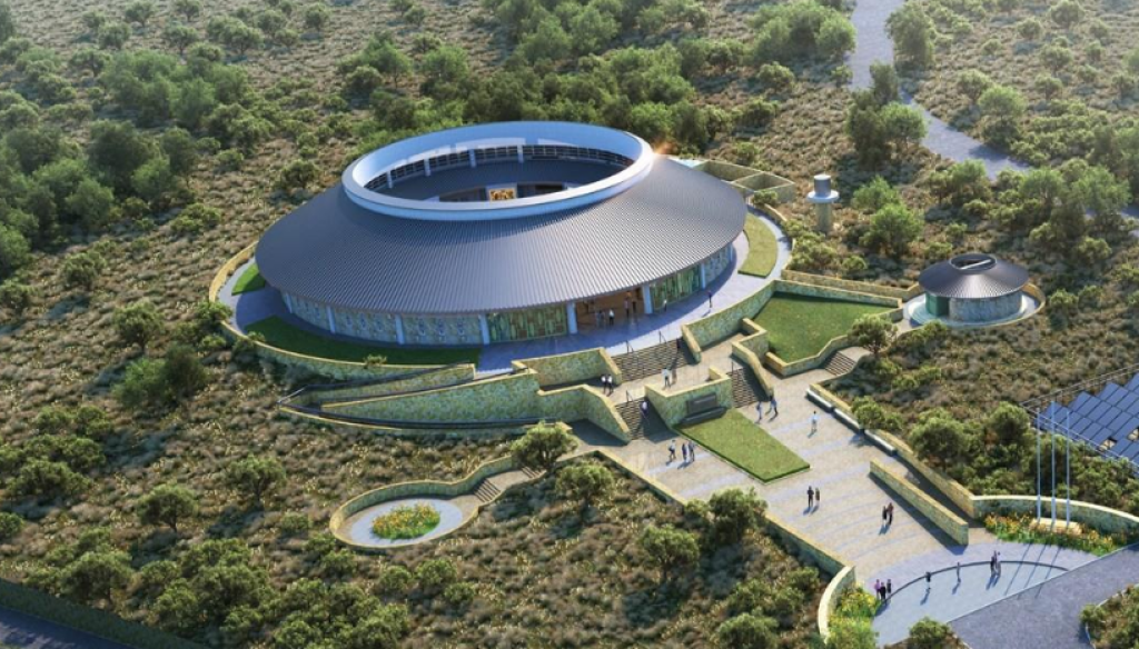
4GEON principles have been projected into presentations in the newly built museum and in interpretations in the field.
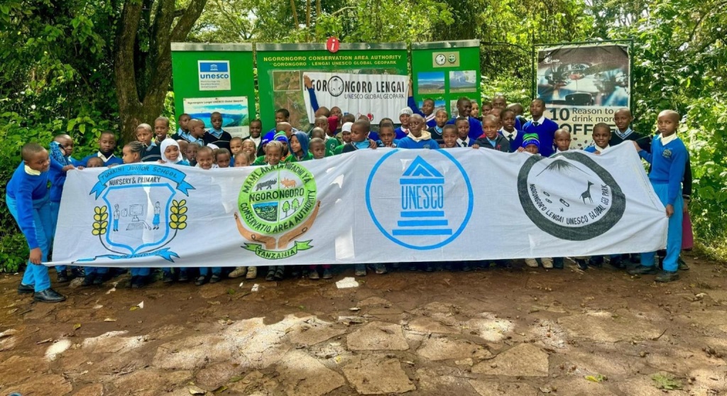
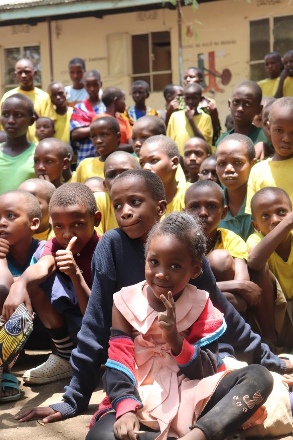
4GEON Club Field Trips in Ngorongoro
Ngorongoro Lengai2025-08-17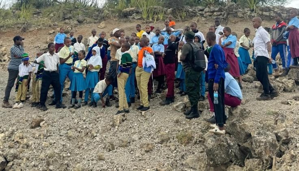
Geopark’s school clubs during field visit to the geosites..
International Day of the World's Indigenous Peoples
BoholColca & AndaguaNgorongoro LengaiRio Coco2025-08-09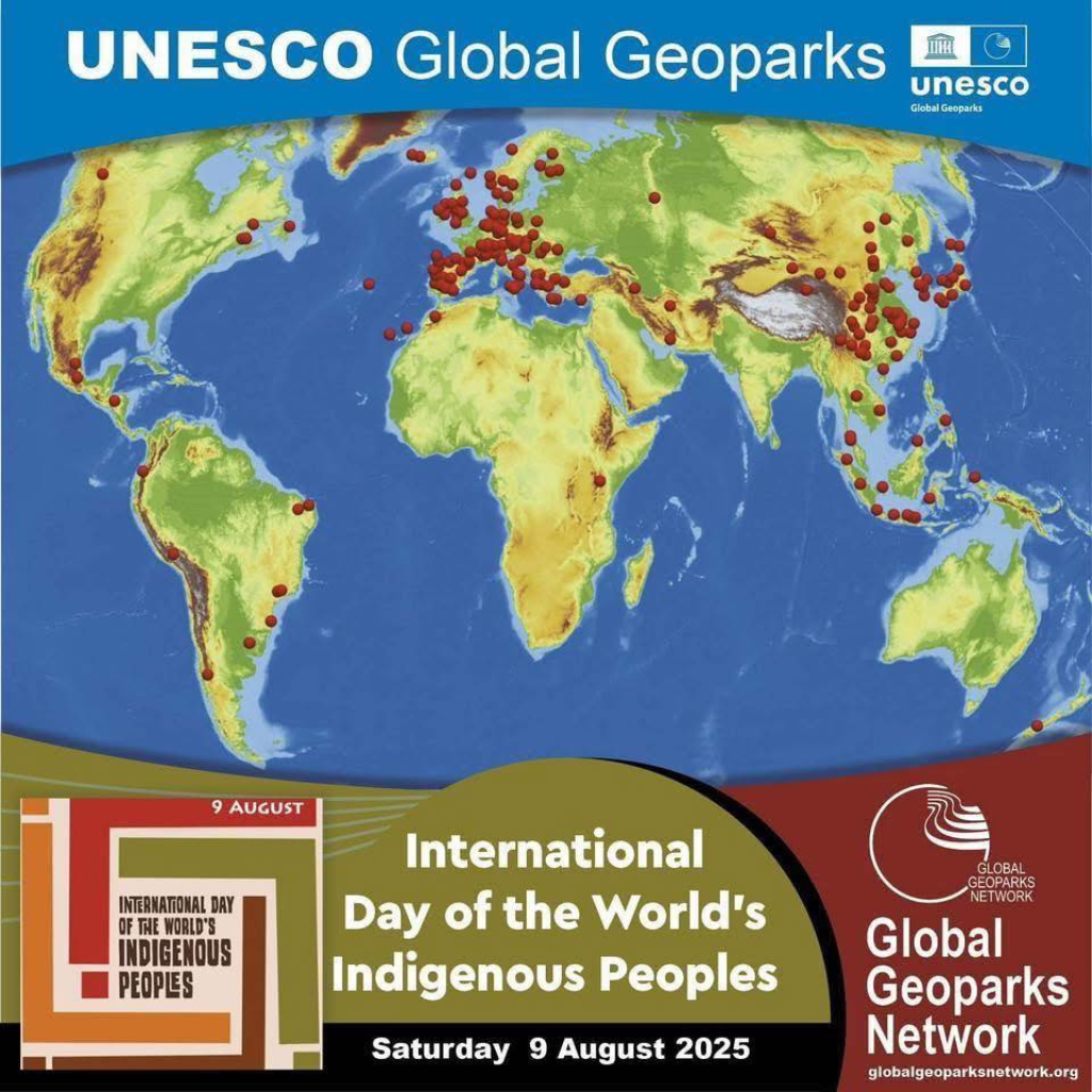
Global Geoparks can provide a respectful place for the Indigenous Peoples of the World that honours and respects their cultural contributions, their language, customs, and their deep understanding of the natural environment. The knowledge and culture of Indigenous Peoples enrich our Global Geoparks. On this International Day of the World’s Indigenous Peoples, Global Geoparks seek to lift up the voices of Indigenous Peoples and to celebrate their knowledge.
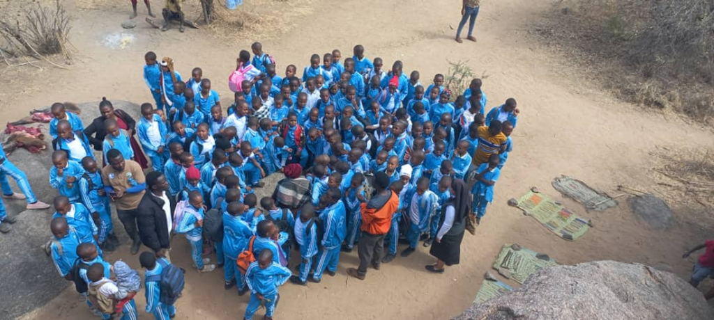
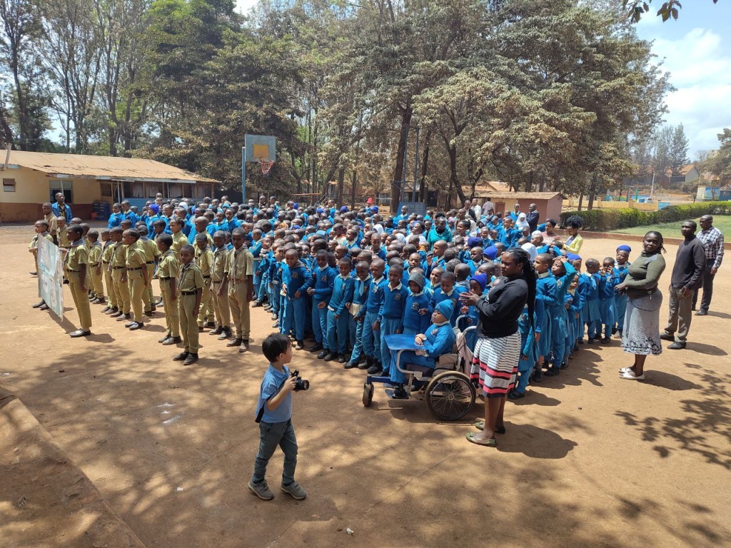
4GEON Clubs in Ngorongoro Crater
geobusNgorongoro Lengai2025-06-27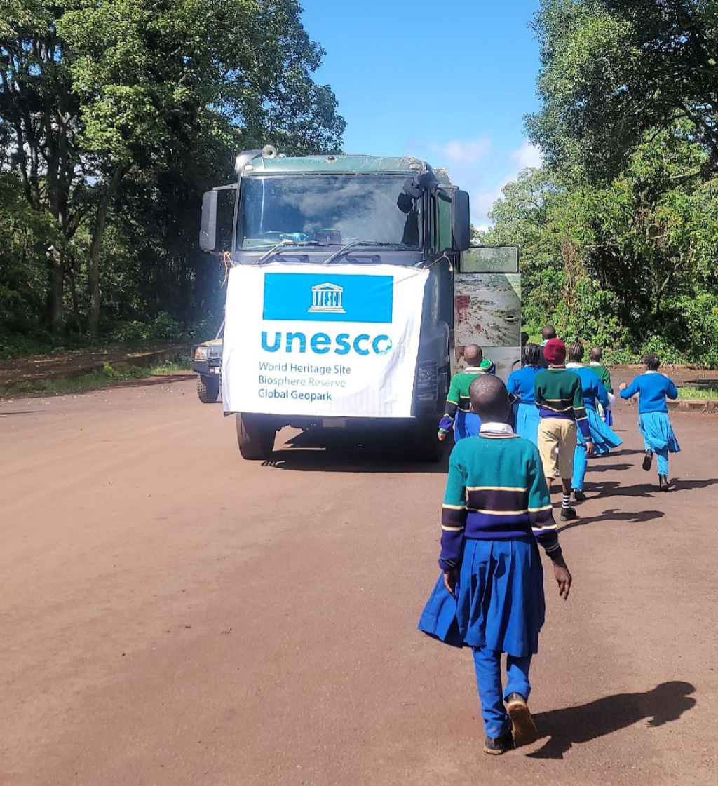
Many kids from schools in the Ngorongoro-Lengai wider area visiting the crater for the very first time thanks to the local 4GEON team-coordinated effort.
Hooray! The Ngorongoro-Lengai Geobus
geobusNgorongoro Lengai2025-05-30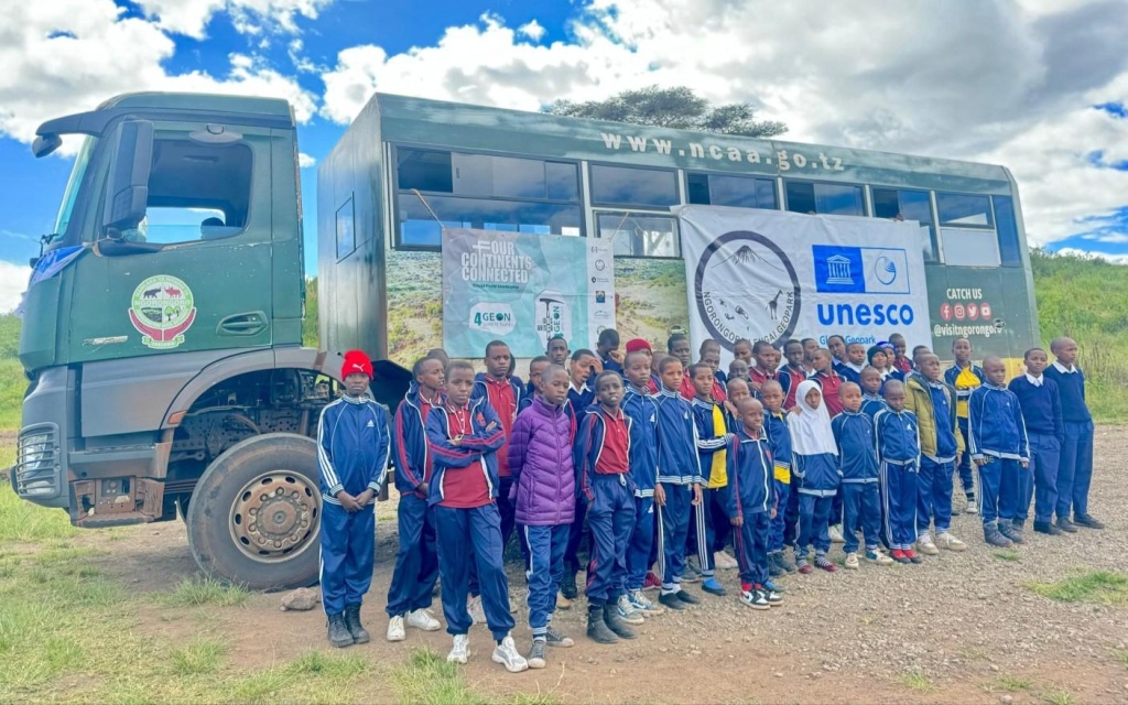
Finally, a more spacious vehicle has been acquired to serve the Ngorongoro-Lengai Geopark, including for conducting field trips for 4GEON Club members.
Celebrating Earth Day
BoholColca & AndaguaNgorongoro LengaiRio Coco2025-04-22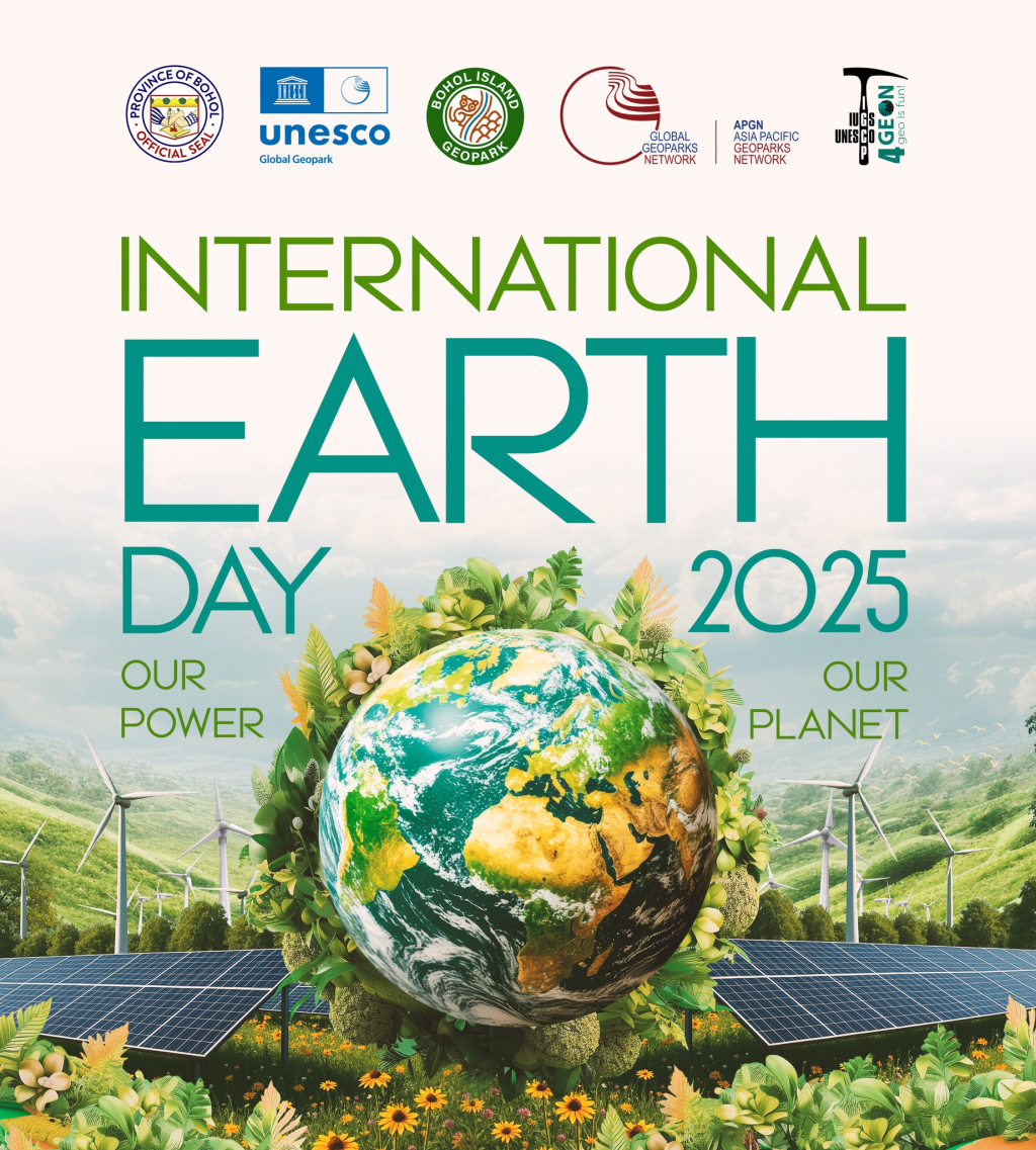
This year’s theme — “OUR POWER, OUR PLANET” — is a powerful call to action. Together, we can shape a future fueled by clean, renewable energy and triple global renewable electricity generation by 2030.
Celebrating International Day for Education 2025
BoholColca & AndaguaNgorongoro LengaiRio Coco2025-01-24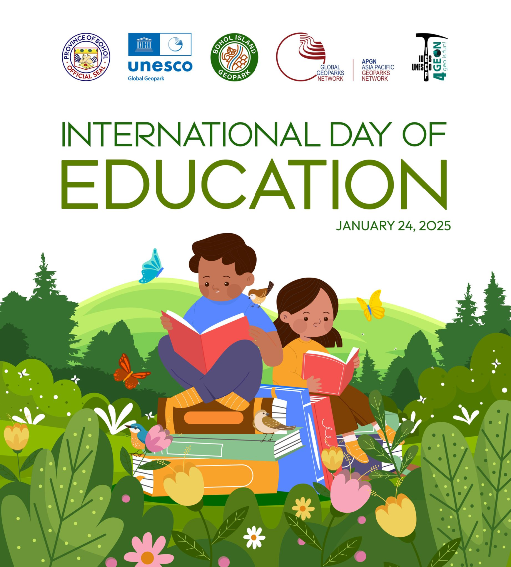
4GEON geoparks are living classrooms where knowledge thrives—from the unique geological wonders of our geosites to the vibrant stories of our cultural heritage. Together, we inspire future generations to care for our environment and celebrate our identity.
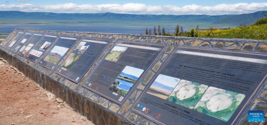
Ngorongoro significant sights and Its protection
Ngorongoro Lengai2025-01-09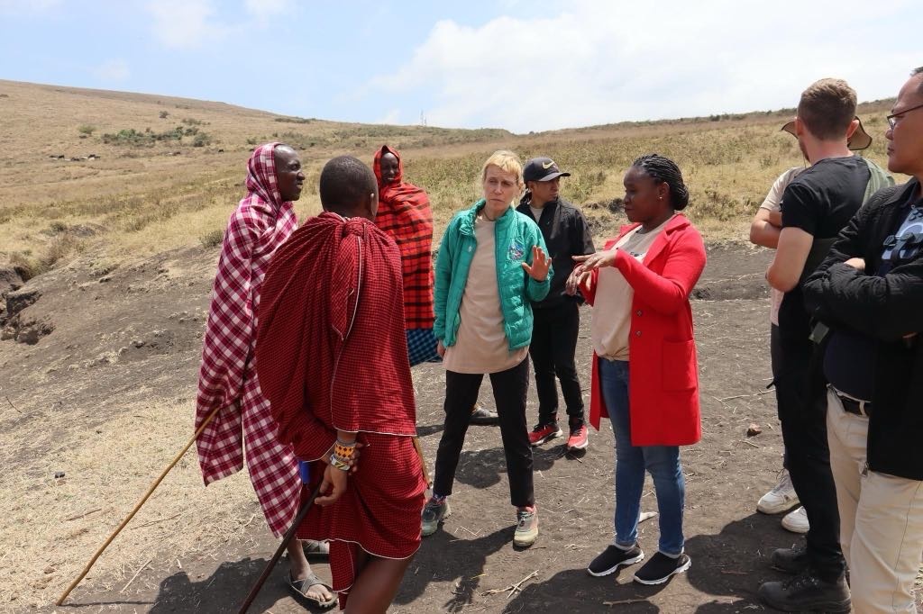
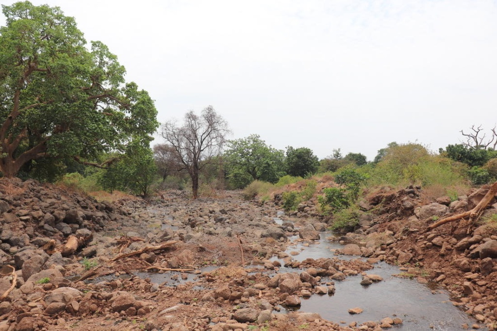
The Ngorongoro Geopark is a UNESCO-listed site of immense natural and cultural significance, encompassing diverse landscapes and rich wildlife. Among its highlights are the Endoro Waterfalls, a serene natural feature, and the Elephant Caves, remarkable formations carved out by elephants seeking essential minerals. These unique locations provide visitors with both scenic beauty and insight into the behaviors of local wildlife.
Park rangers play a critical role in preserving this ecosystem. They guide tourists along well-maintained forest trails through lush bushlands, ensuring a safe and enriching experience. Additionally, they engage in crucial conservation efforts, such as controlling invasive species like jimsonweed, which threaten native vegetation, and actively protect the area from illegal poaching activities. This combination of natural wonder and dedicated stewardship makes Ngorongoro an exceptional destination for eco-tourism and sustainable travel.
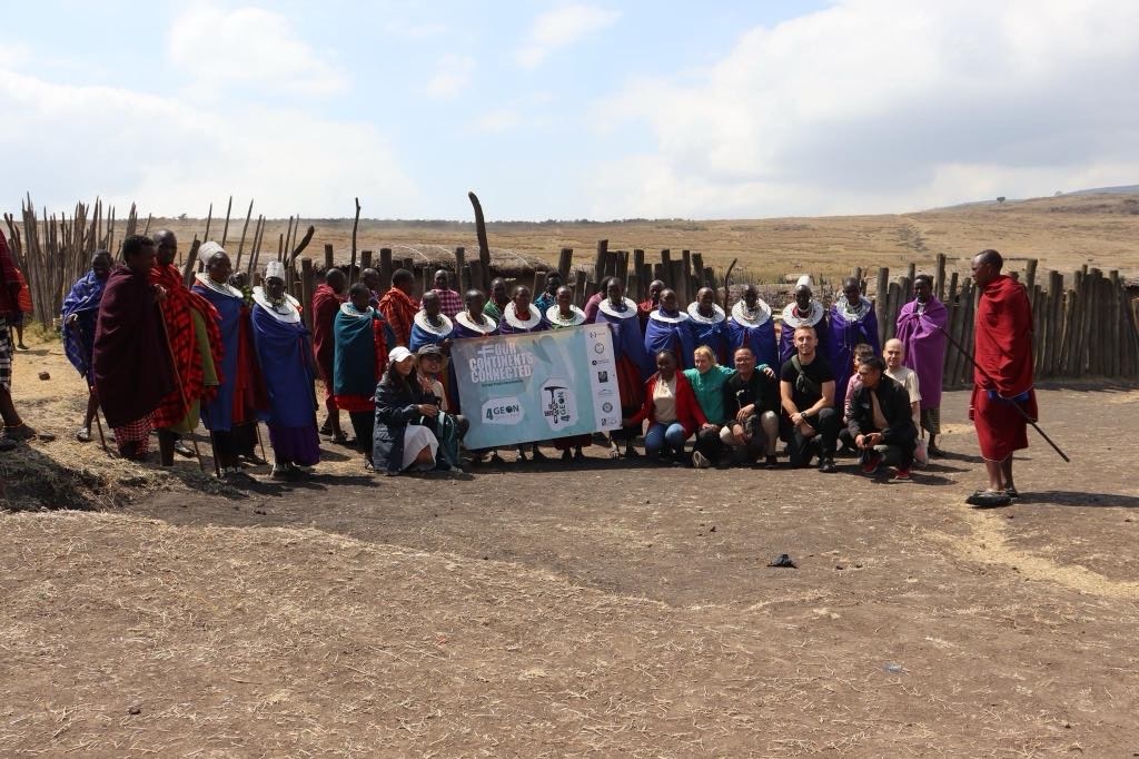
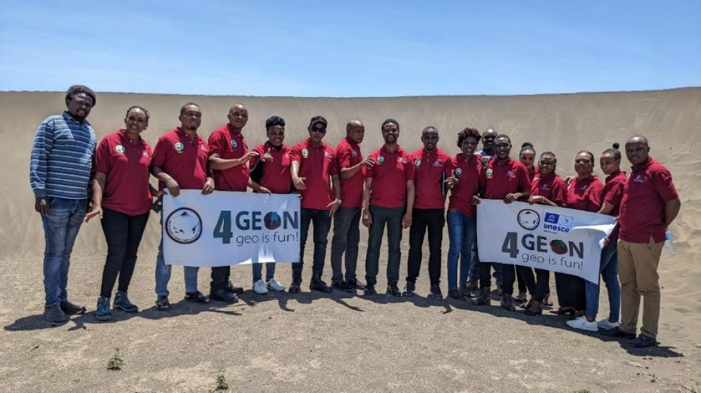
The Third Annual 4GEON Meeting in Tanzania - The Final Report
geobusgeocontestgeocoursegeoportalNgorongoro Lengai2024-12-15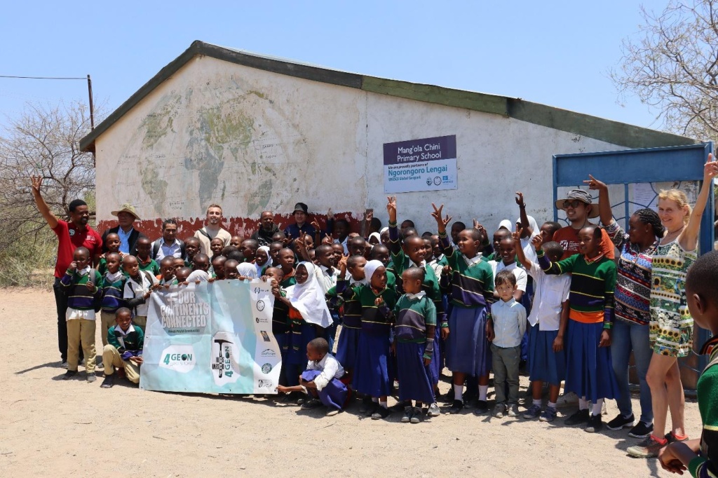
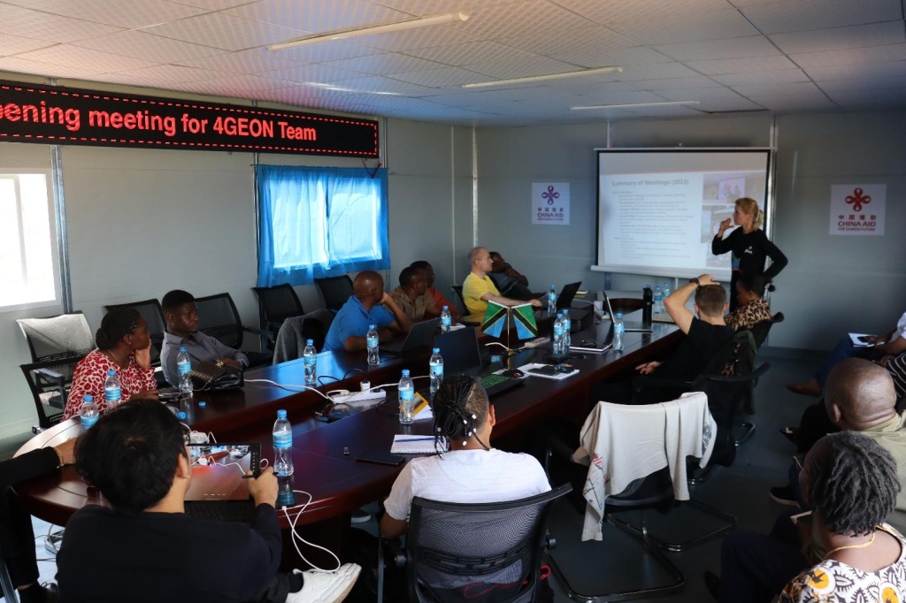
The third 4GEON face-to-face annual meeting of the project team was held in Tanzania, at the Ngorongoro Lengai UNESCO Global Geopark. It was 9 days of intense program, focused on geoscience education development and practical steps in local school engagement, sustainable tourism, and community involvement, and meeting Indigenous group representatives.
Several Interim workshops focused e.g. on 4GEON information systems and the potential of generative AI in geoeducation. The meeting resulted in feedback for Ngorongoro Geopark, fostered multilateral geopark-to-geopark senior-junior experience exchange, deepened cooperation with local geoschools as well as an action plan with tangible tasks and goals. Download
On September 29, 2024, a visit was dedicated to Manyara National Park
Ngorongoro Lengai2024-09-30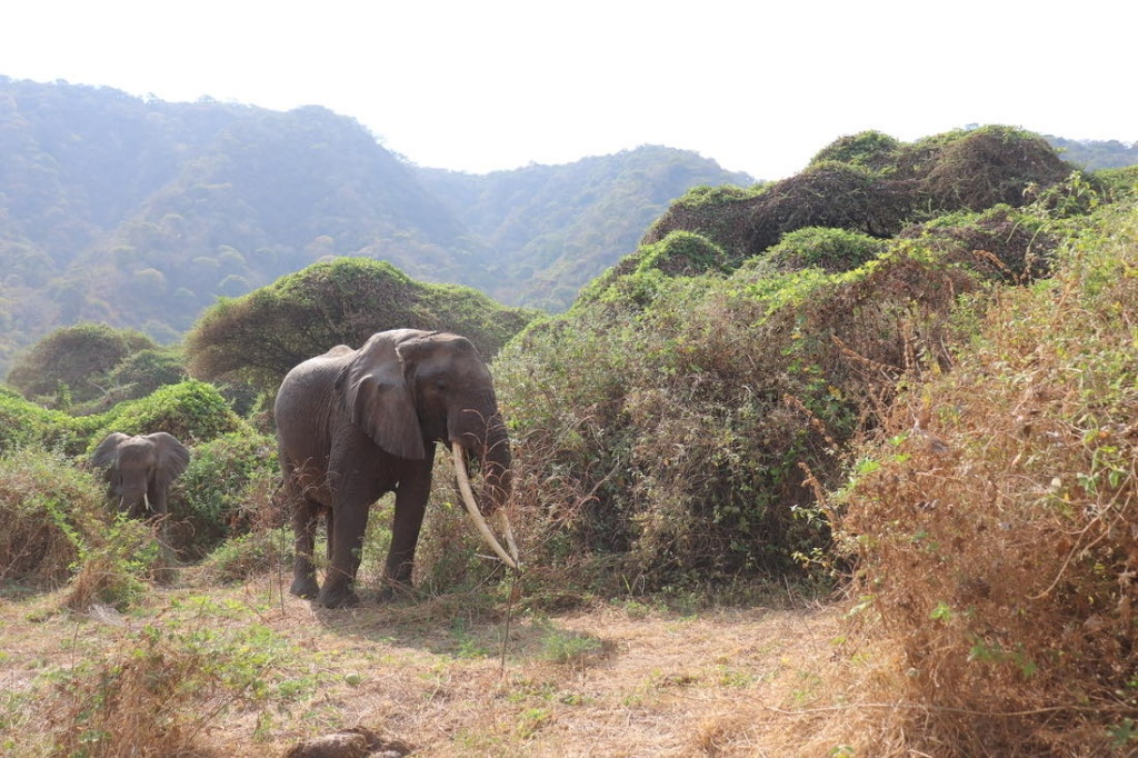
Which ensures the protection of a diverse community of species around the lake of the same name. Although the national park lies in close proximity to the Ngorongoro caldera (crater), it is dominated by different habitats – the lake itself, which serves as a refuge for numerous bird species, the adjacent swamps, and the tropical forest🌿, which rises sharply from the plains around the lake to the steep volcanic cliffs surrounding Ngorongoro. With some luck, one can spot not only lions🦁, various species of monkeys🐒, antelopes, and birds, but also lions resting in the treetops, especially during the rainy season🌧️. 👣During the visit, the team also became acquainted with the organization of tourism in national parks and with the differences in the approach and intensity of protection in national parks compared to Ngorongoro, which is a conservation area.
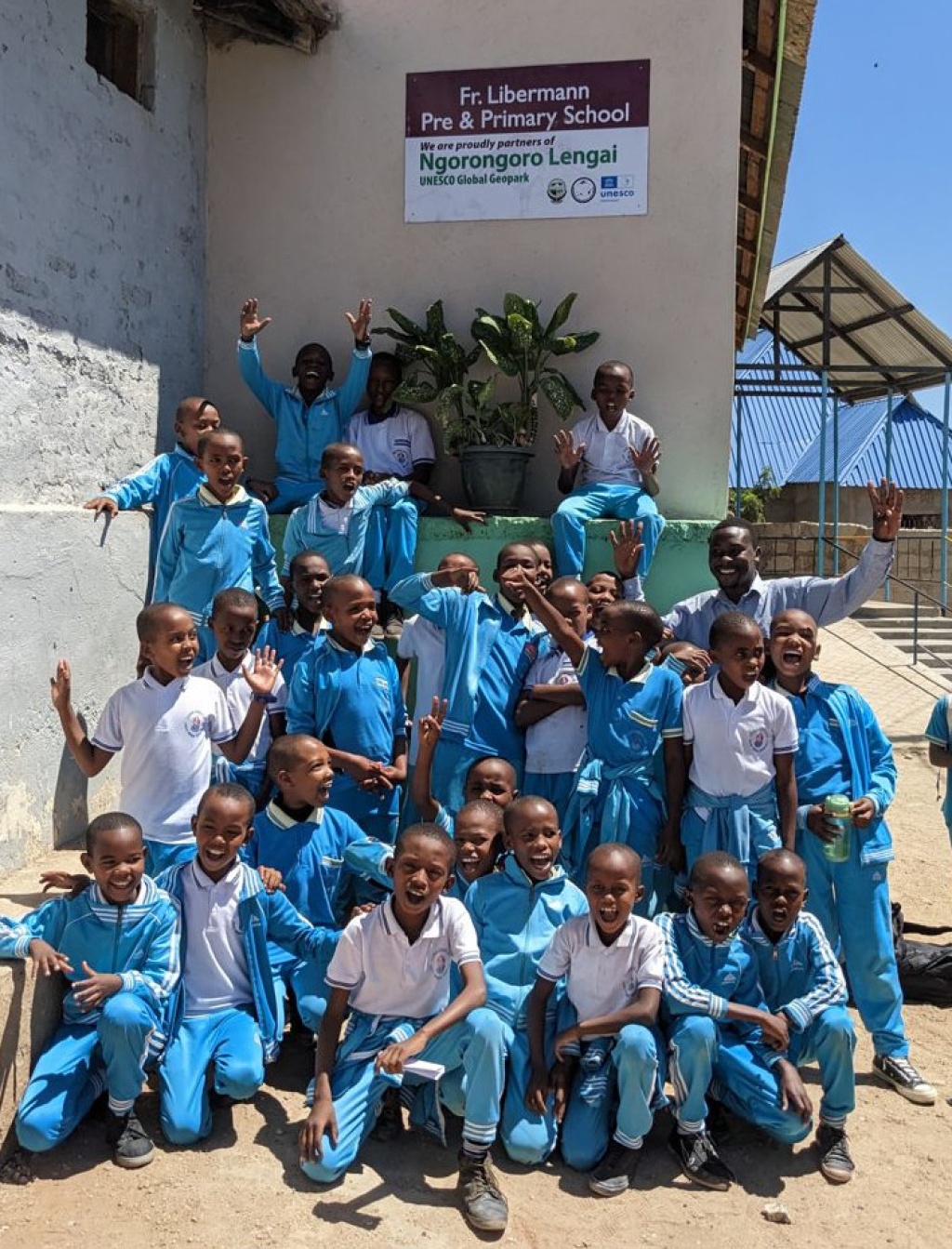
26.9.2024 team members visited two schools in a remote part of the district Arusha
Ngorongoro Lengai2024-09-29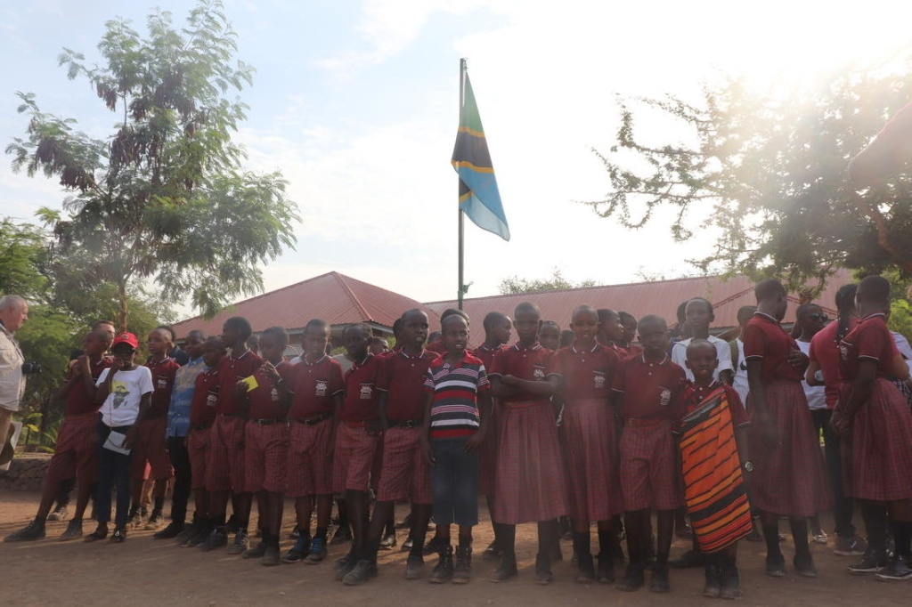
Near Lake Eyasi in the central part of the Rift Valley. 🌎📚 In the Church Primary School Fr. Lieberman they attended a meeting for parents
and friends of the school, which included a presentation on the activities of the geoscience club. ⛪️
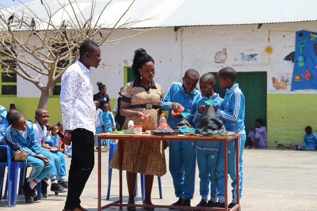
This was followed by a meeting with the school administration and teachers regarding 4GEON activities and a discussion on the aspect of their possible further enrichment. 🤝 Similarly, in the nearby Mang’ola government primary school, geo-club students presented the club’s activities, outputs and benefits from visits geo-locations and the knowledge gained. In the discussion that followed, the value of
of not only natural but also cultural wealth - customs, language, traditional knowledge. 💡 Through the chairman and the spokesperson of the club, students presented to the 4GEON team a plea for help in securing a connection to the internet and technical resources that the school does not yet have and which would add an important new dimension to the learning experience, including, for example, the possibility of connecting with students from other geoparks. 🔗 Specific possibilities for assistance were then discussed with the school management. Finally, the team visited local tribal communities - Hadzabe bush people and Datoga pastoralists, who introduced them to some of the their knowledge, skills and way of life.🏞️
On September 26, 2024, a technically oriented workshop
Ngorongoro Lengai2024-09-26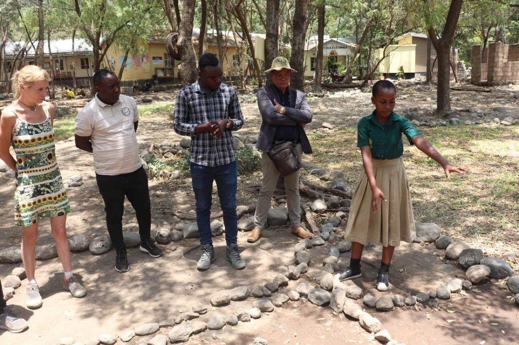
Took place, during which progress in the development and implementation of the project’s information tools was presented – specifically the GeoEduGame media portal and the Toursman system, designed to support destination management, integrated with a mobile tourist guide application.✈️📲 This application offers advanced tools for monitoring and managing tourism in the destination📍. The workshop also included a presentation on the potential use of current generative artificial intelligence tools in promoting the activities of geoparks and enriching school education📚. In addition to those physically present, about 10 other participants from the Czech Republic🇨🇿 and the Philippines 🇵🇭 joined virtually. After the workshop, the team visited a nearby gallery and market in Karatu for a brief tour of a tanzanite exhibition – a blue or violet variation of zoisite, whose only known deposit is near Mount Kilimanjaro.🏔️
representatives of the project visited three selected UNESCO schools in Karatu
Ngorongoro Lengai2024-09-26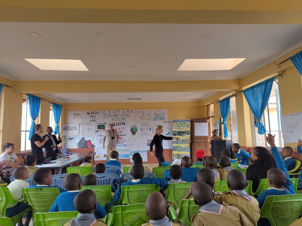
These schools together teach over 2,000 students from 6 to 18 years of age. 🏫🌎 The visits included discussions with school management and selected teachers on the education system in Tanzania,📚 the methods used and possible ofintegrating geoscience education into the curriculum,
presenting activities and outcomes of the members of the school 4GEON clubs, a brief introduction of the Bohol, Colca geoparks,🏞️ Barrandien to students including video demonstrations, discussion with teachers and students on the project, its benefits so far and concrete ways to further to support teaching with the help of the 4GEON project in the spirit of its motto “geo is fun!”.😁
Fourth day of the meeting of the 4GEON project
Ngorongoro Lengai2024-09-25

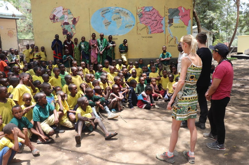
🌎Fourth day of the meeting of the 4GEON project. The team visited the cultural boma of the Maasai tribe. The visit anabled to became familiar with the way of interpreting their original lifestyle. We had the opportunity to visit their kindergarten. Then we went to the Olduvai valley. ⛰️ On the way, we stopped at the Ngorongoro Lengai UNESCO Global Geopark Information Centre. The next stop was the Shifting Sands geosite. From there, we drove to the place where the skull of Paranthropus boisei was found. Next, we arrive to the Olduvai Gorge Site Museum, where we saw the exhibition and visited the community centre for local tribes. All this was accompanied by a magnificent view of the cradle of mankind.
On 24 September 2024, were presented topics within the 4geon project. Down below are topics with key information
Ngorongoro Lengai2024-09-24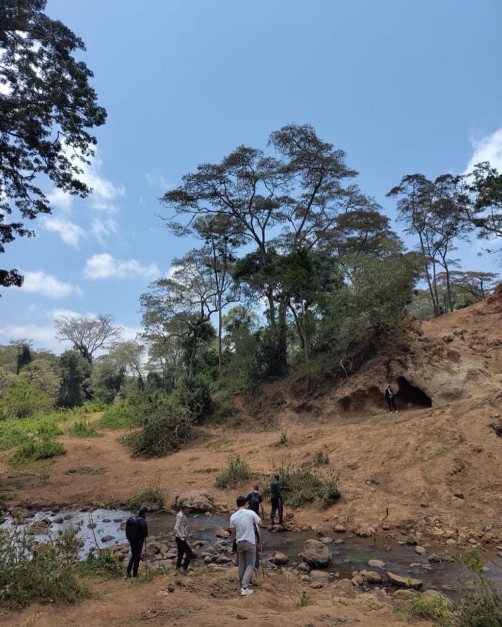
4GEON project as a tool for sharing playful geoscience knowledge 🔧 Including: 4GEON Project Introduction, Participating Geoparks, Promotion, Partnership Conference and Workshops, Project Outputs, Current activities.Updates from Bohol Island UNESCO Global Geopark 💡 Including: Bohol Island UNESCO Global Geopark Management Council, Geopark Management Section Structure, First Bohol Island Geopark Youth Camp, Promotion and visibility, Eskaya Indigenous community development Ngorongoro-lengai geopark progressive report📜 Including: Geoheritage of Ngorongoro-Lengai, Geohazard, Environments, Culture, Geoscience around us, Wildlife, Geotourism, 4Geon Project
On September 23, 2024, 4GEON visited significant locations within the Ngorongoro Geopark and protected area
Ngorongoro Lengai2024-09-23

including the Endoro Waterfalls and the Elephant Caves 🐘 (carved out by animals that come to the site as a source of minerals). While on-site, the team familiarized themselves with the work of park rangers👮♂️, who maintain the tourist infrastructure🚗, guide visitors along forest paths through the bush🌳, combat invasive plant species (such as jimsonweed🌿), and deter poachers. The day ended with a meeting with representatives of the Iraqw tribe, who strive to preserve and promote their traditions and values at a cultural boma they operate independently☀️.
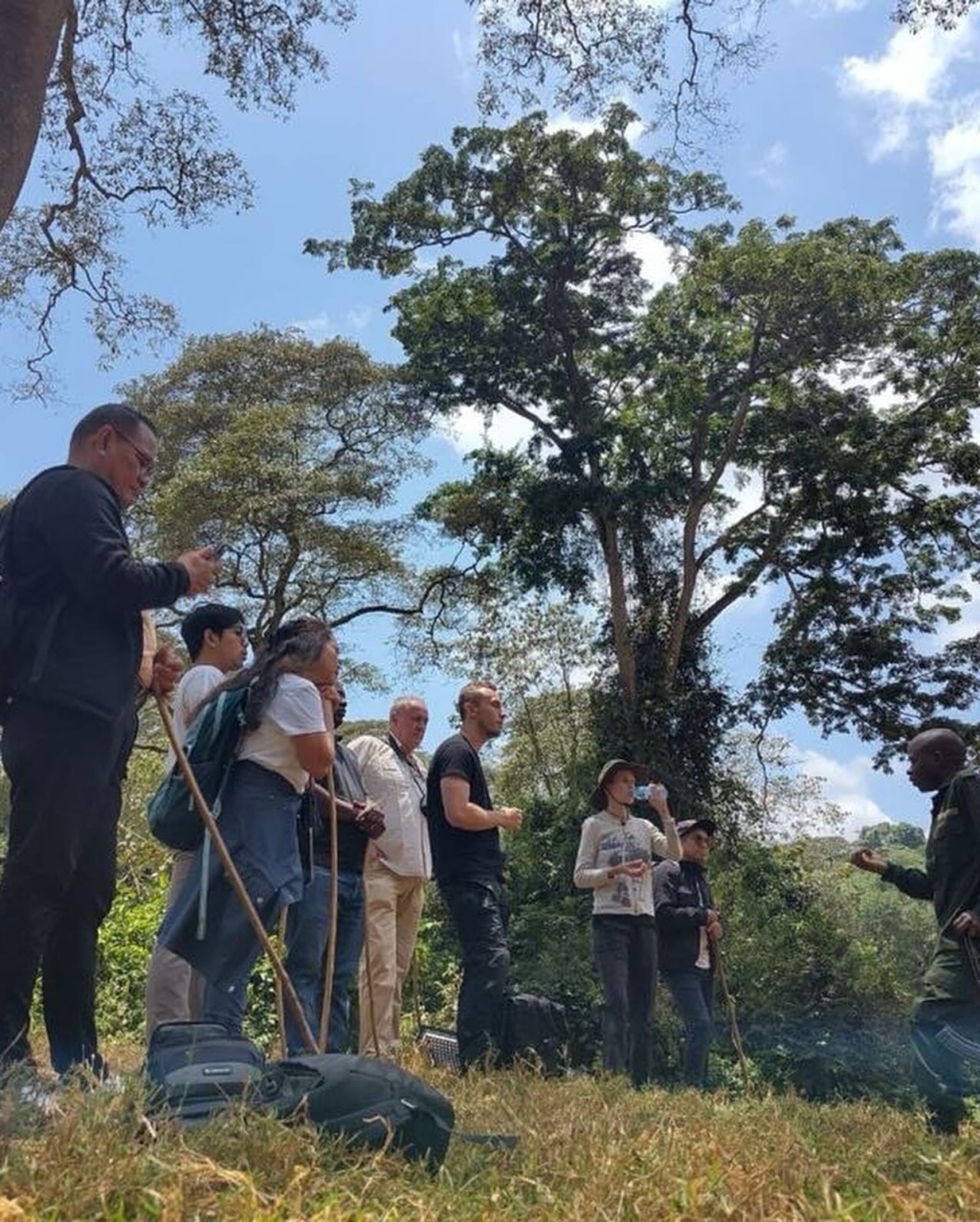
Today 22.9.2024 the participants of this year’s 4GEON meeting visited a key territory host geopark - Ngorongoro Crater
Ngorongoro Lengai2024-09-22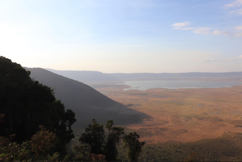
It is one of the biggest of volcanic calderas in the world 🌎, in the heart of which a colorful savannah ecosystem arose interlaced lakes, marshes and streams and which provides habitat for a number of iconic animals of Africa 🦓🦒. During the visit to the territory, the team focused on interpretation of natural and cultural values provided by the global the Ngoronogoro Geopark, on the territory’s potential in terms of its further development sustainable development of tourism and the possibility of using information technologies in territory management 🌱
Pupils from Tanzania and Azores (Portugal) connected
geocourseNgorongoro Lengai2024-05-27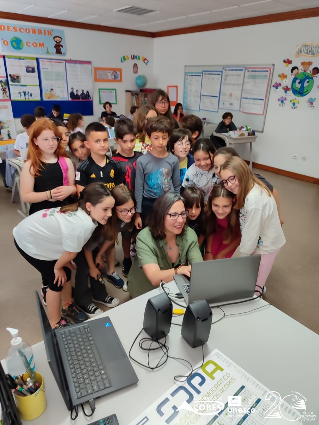
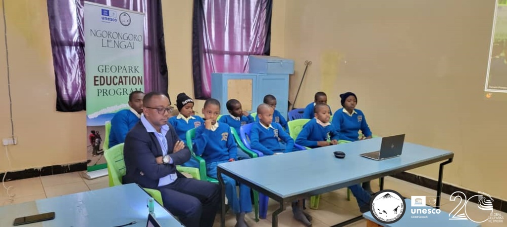
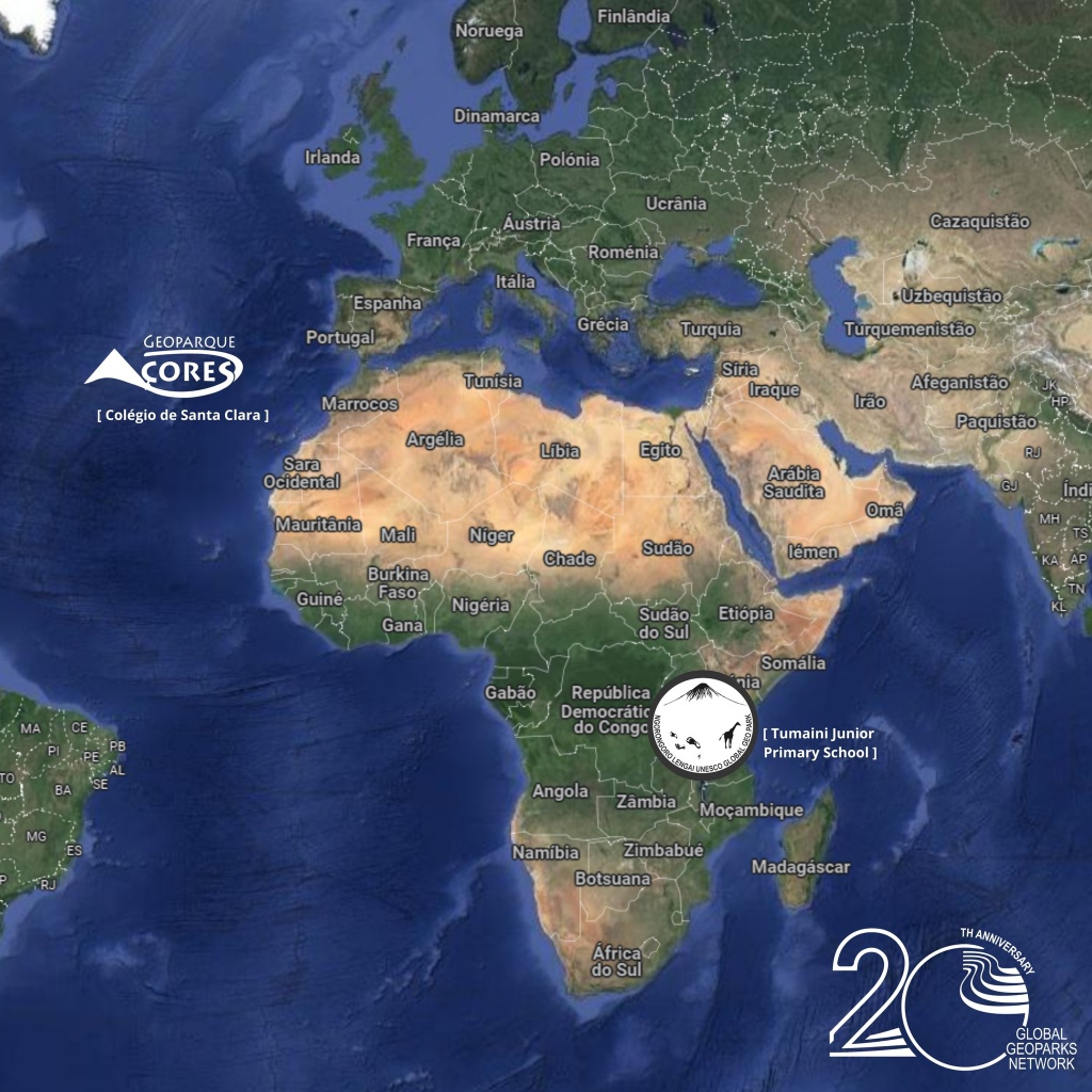
The UNESCO Global Geoparks Nagorongoro Lengai (Tanzania) and Azores (Portugal) arranged a digital meeting between students from these two territories. The meeting was a culmination of a multidisciplinary work carried out by students and teachers, rediscovering their territories and presenting them to peers, so far away geographically but so close through the Global Family – Global Geoparks Network. Thanks to Colégio de Santa Clara and to Tumaini Junior Primary School! Read more
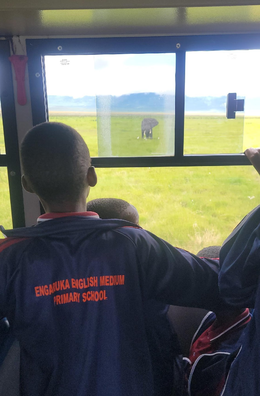
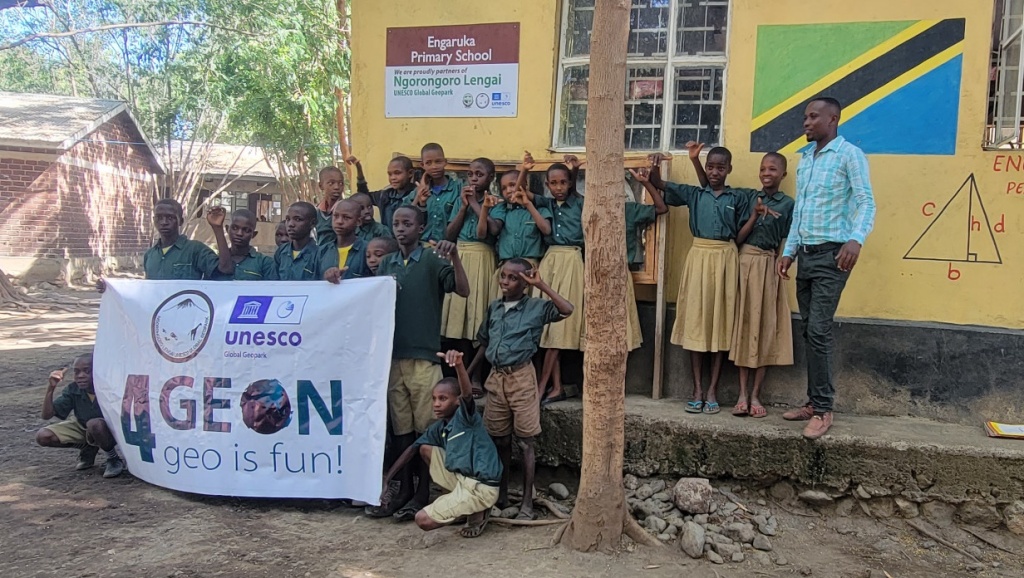
Geoeducation in Tanzania
geocourseNgorongoro Lengai2023-12-18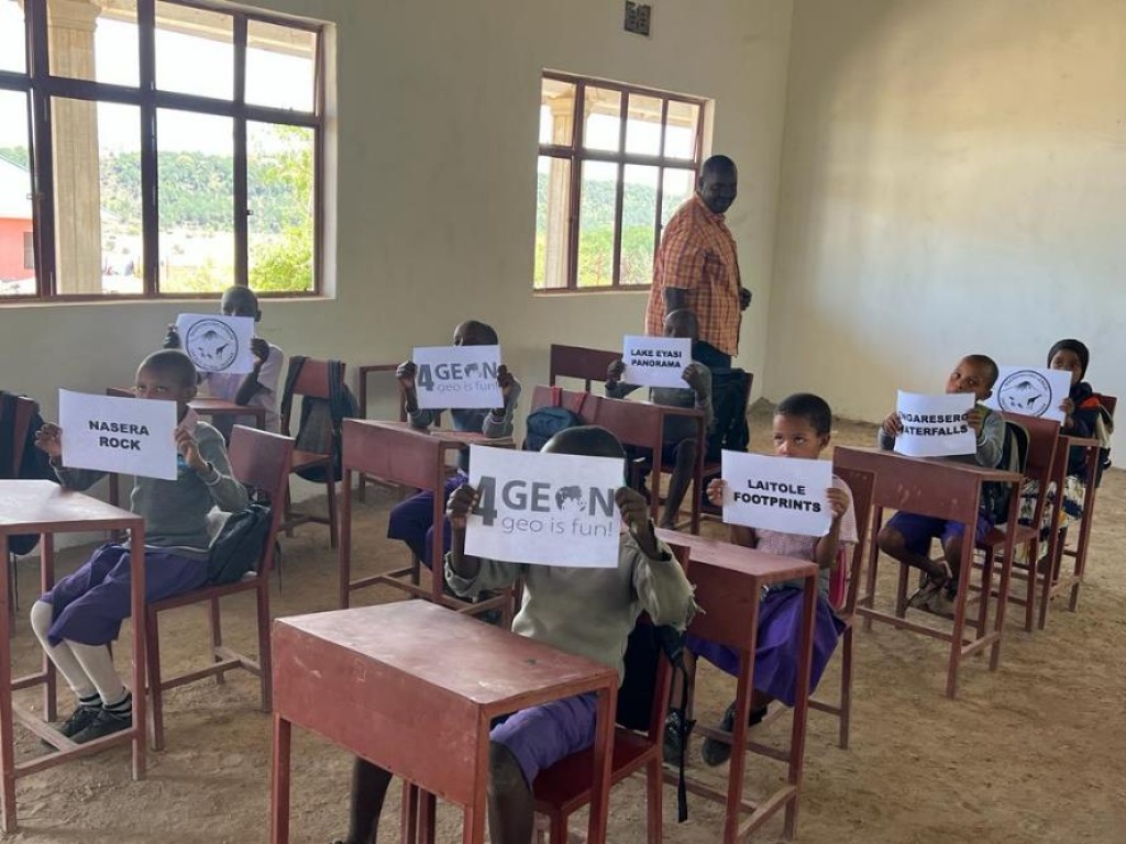
School education programme at Engaruka primary school and a training session in Karatu District with 4GEON project support was realized. The last picture documents a meeting with local community at village Eyasi in Karatu district on 4GEON mission, activity implementation and other geopark issues.
Geo-educational training for teachers in Tanzania
geocourseNgorongoro Lengai2023-12-15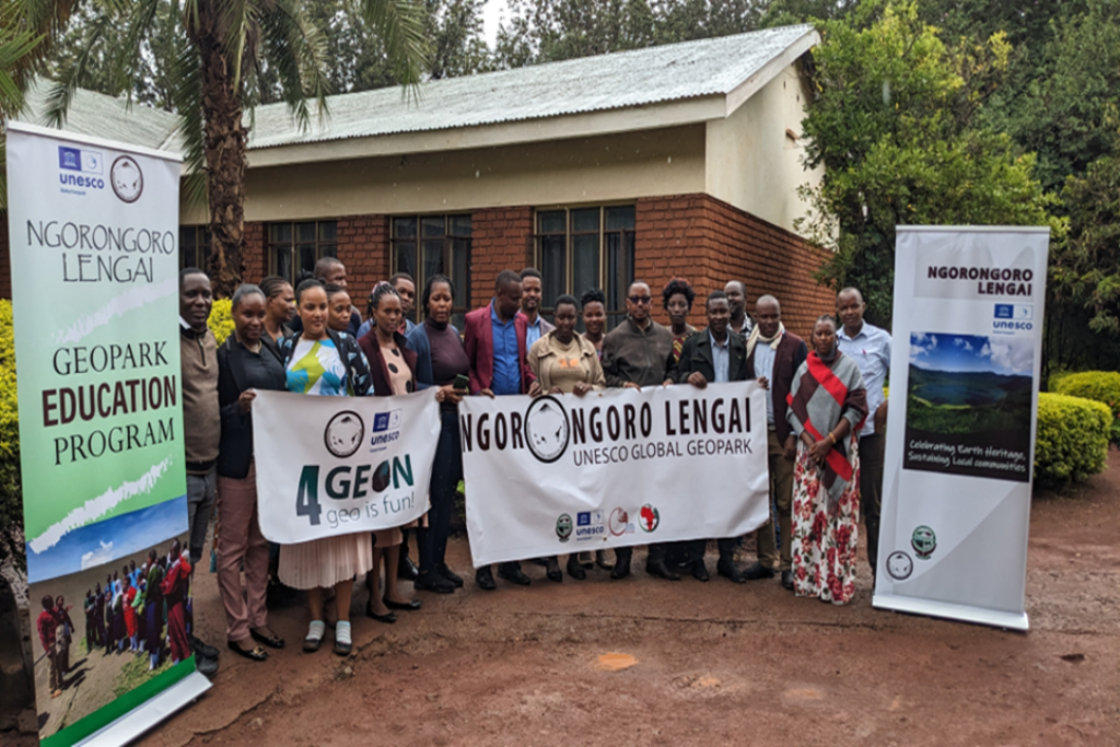
Teachers from schools in the area are being trained in geopark-related topics.
Youths involved in Geodiversity Day celebrations in Tanzania
geocourseNgorongoro Lengai2023-10-07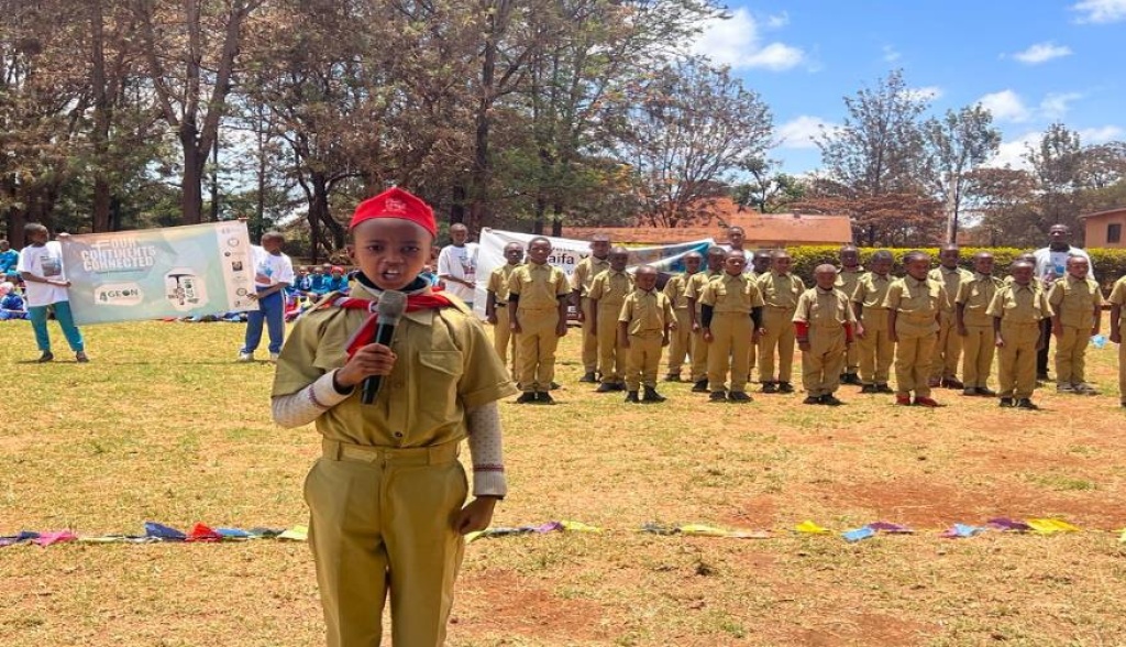
The School Scout Troop of the Geopark was fully involved in the Geodiversity Day celebrations.
Ngorongoro progress presentation
Ngorongoro Lengai2023-08-08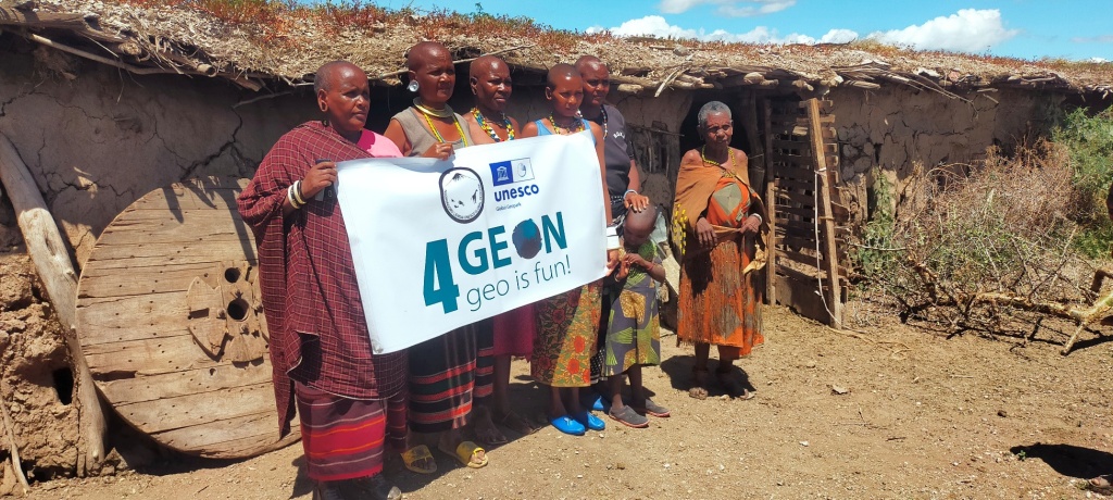
Intense cooperation with schools in the region, a new geopark club and geopark competetition, etc. Good job reported from Tanzania! Download
International Geodiversity Day at Tumaini Junior School
geocourseNgorongoro Lengai2023-08-06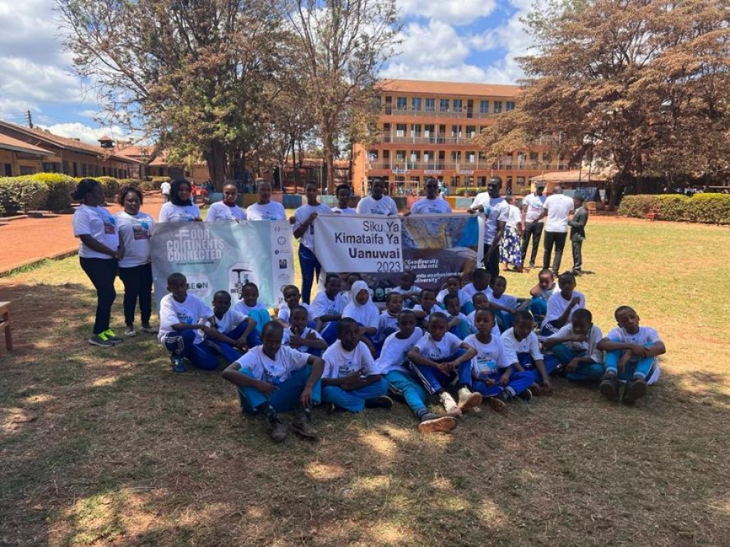
With the support of the 4GEON project, the International Geodiversity Day was celebrated at Tumaini Junior School by team members from the Ngorongoro Lengai Geopark, Tanzania.